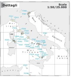
Large-scale Italian coastal charts

Large scale nautical charts of the national coasts with the area represented on one side and the respective pilot book on the opposite side.
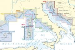
Mediterranean nautical charts
At sea the captain with prudence and navigation skills will always know how to solve a problem, read a nautical chart, be it of the coasts or large scale, coastal or general, know how to use the tools for the correspondence and establish the best route are unquestionably skills necessary to undertake more demanding navigation. Having an updated Navimap nautical chart on board the sea area where you are going to sail can avoid unpleasant surprises and is always recommended. Below are the large-scale Navimap maps and the coasts of the Italian seas, divided by area and have a scale ranging from 1: 25,000 to 1: 40,000 on two sides of size 47.7 x 69.7 cm.