Small scale coastal nautical charts
Large-scale nautical charts of the Italian coasts with large sectors represented on both sides for medium navigation.
-
-
- Navimap marine chart FR104-IT101 Sku code: 70.251.01Special Price €25.33 Regular Price €26.15Out of stock
-
- Navimap marine chart IT108-IT109 Sku code: 70.251.05Special Price €25.33 Regular Price €26.15Out of stock
- Navimap marine chart IT136-IT137 Sku code: 70.251.17Special Price €25.33 Regular Price €26.15Out of stock
- Navimap marine chart IT104-IT105 Sku code: 70.251.03Special Price €25.33 Regular Price €26.15Out of stock
- Navimap marine chart IT124-IT125 Sku code: 70.251.13Special Price €25.33 Regular Price €26.15Out of stock
-
-
-
- Navimap marine chart IT128-IT129 Sku code: 70.251.15Special Price €25.33 Regular Price €26.15Out of stock
- Navimap marine chart IT120-IT121 Sku code: 70.251.11Special Price €25.33 Regular Price €26.15Out of stock
-
-
- Navimap marine chart IT112-IT113 Sku code: 70.251.07Special Price €25.33 Regular Price €26.15Out of stock
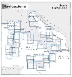
Nautical charts 1:250000
If you want to experience navigation propely, having on board an updated Navimap coastal nautical chart of the sea area where you are going to sail can avoid unpleasant surprises and is always recommended. Below the Navimap maps of coastal Italian seas, divided by area, have a scale of 1: 250,000, the areas are represented on two sides, the dimensions of the coastal maps 1: 250000 also known as medium navigation are 47.7 x 69 , 7 cm.